Flood Maps
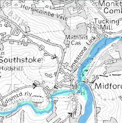
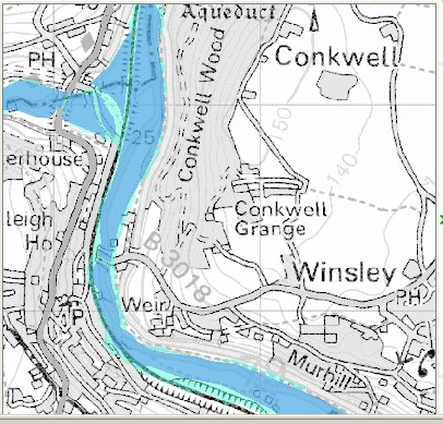
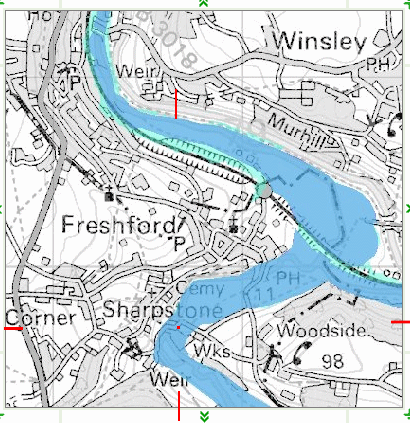
Adjoining Flood Maps and one of the City of BathMost of the roads in the area of the Frome Valley are threatened with flooding and may be effectively closed to traffic. I wouldn't have thought that the A36 viaduct at Waterhouse (shown on the Conkwell/Winsley map) would be threatened though, unless the piers could be undermined. Apparently this is actually happening as the A36 road is to be closed to all traffic to allow for work on the viaduct (due to start 31st March 2008) The affect of flooding is extensive. Every road that crosses the rivers Frome, Midford Brook and Avon can be affected. The bridge at Bradford on Avon can be closed, coupled with flooding at Staverton Mill the area south of the Avon can be isolated from the north of the Avon and traffic from the M4 and A4 would need to be diverted, if they know about it, to the A350 into Trowbridge or to the A46 into Bath. This might not seem too important as such flooding is still infrequent - every three years? But, getting someone to a hospital becomes more and more problematic, especially when so many local hospitals are closed or threatened with closure. Obviously, many people will be unable to go to work or get home from work, without a time consuming detour A few years ago a fire engine was washed off the road by flood water at Freshford. Given that the engine weighed 13 tons or so it provides a graphic example of the power of the flood water and this was in the flood plain not in the narrow confines of the river bank! and as it could not arrive at its destination in time there could have been loss of life. The army had to come from Warminster to extricate the fire engine from the ditch it was lodged in. Copies of newspaper photographs of this flood are included in the Parish Council Comments document. I used my camcorder to record the event which was shown on HTV news. Unfortunately, they have lost the tape, so I am unable to provide a video clip here. It is most unusual to see the rescuers being rescued!
|
|||||
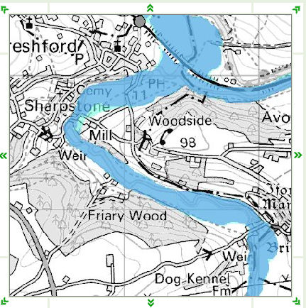 |
Freshford Mill: Updated Flood Map March 2008In spite of requests to change this misleading depiction of the location of Freshford Mill and the former Peradins buildings the Environment Agency have not only rejected the obvious, but also decided to reclassify this area of the Frome and Avon valley flood risk maps. DEFRA has reclassified the risk as being lower! Now a substantial area of the property is now only subject to the "One in a Hundred Years" extreme flood. These maps indicate to concerned members of the public who use the Flood Risk maps that the residential buildings approved for the site (by those who should know better) that their houses will be on the edge of the risk to flooding rather than beside the river. Link to OS Maps added March 23rd 2008
|
||||