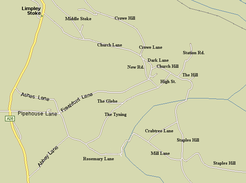
Click on the map below on the road junctions to see photos of that particular road junction or refer to the website index to access the photographs of each junction directly
|
|
|
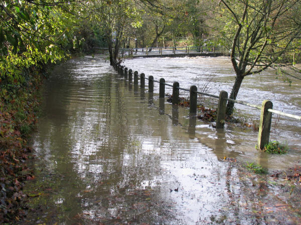
The road map has been prepared from my copy of Microsoft Autoroute with a few corrections. Note the A36 to the left hand side. Church, Abbey, and Ashes Lanes meet the A36. The other lane Pipehouse Lane also meets the A36 but is one way-in to Freshford. Church Lane is the existing main route motorists use to reach the A36 going to Bath and Bristol and returning. There is no place to change direction in Church lane, apart from by the church -three-point turns (3PT), where the narrow lane leads to Middle Stoke. Or by using peoples' driveways to carry out 3PTs. The photos were taken in 2005 and 2006. Video films of journeys into Freshford This means that parents dropping off children at the school who are travelling from the Staples Hill direction would need to travel up Freshford Lane and then either drive back via The Tyning or via Rosemary Lane. Or use the private drive to the houses opposite the school, which is a dangerous manoeuvre with small children nearby. At present there are few parents who drive from the Staples Hill direction. But there will inevitably be many children if 21 dwellings are approved for the Freshford Mill site. (Photo of flooded Rosemary Lane and Freshford Mill bridge below) |
 |
|
When the lower part of Staples Hill just by the bridge at Freshford is flooded the postman/woman has been known to drive along the A36 and take the Farley Hungerford road in order to deliver the Royal Mail to residents of Staples Hill. A distance of approximately 6 miles! Owing to the distance from Freshford Mill to the village school, and the associated risks of walking along the lanes or the steep often very muddy path through Tyning Woods children born to residents of the new settlement at Freshford Mill would need to be taken by private car (as there is no bus route to the mill) to school in the morning and collected at night.. And when the river Frome is in flood, their journey may be one of 6 miles! As Staples Hill will be impassable. A young child might take 40 minutes to walk such a distance even if the weather permitted. As a retired teacher I wouldn't like to contend with unhappy children covered in muddy foot-ware arriving at school late. |